Link

Beyond the Gulf: Real-Time AUV Tracking
Posted: January 30, 2019

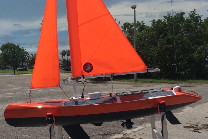
The GCOOS data portal used to track Gulf glider missions in real-time has proven so popular and easy-to-use by glider operators that we’re now tracking other autonomous ocean-going vehicles in other locales. We’ve tracked a Navocean Nav2 Sail and Solar ASV being used to gather data in the Banana River Lagoon on Florida’s east coast.

Navocean and Turner Designs teamed up with FAU/HBOI researcher Dr. Jordon Beckler and 4Ocean to demonstrate mobile fluorometer data collection in support of new techniques to research red tide and other toxic algae blooms — including HABs in Lake Okeechobee — through the deployment of the Navocean “Nav2” vehicle, the first autonomous sail-driven surface vehicle to be used for inland algae monitoring.

Read full article here.

Link

Sail-powered research vessel launched into Lake Okeechobee to study algae blooms

Published: Feb 5, 2019 1:51 EST
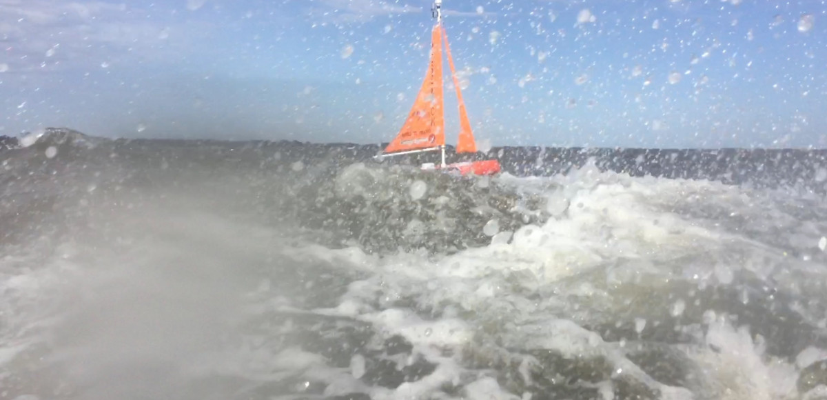
FAU’s Harbor Branch Oceanographic Institute launched its Navocean vessel Tuesday morning from the Pahokee Marina into Lake Okeechobee.It’s a sail-powered mini boat that will travel across the lake via determined plot points to collect data that will help researchers better understand harmful algae blooms.

They have already collected data off Sanibel Island for red tide. This time, they’re studying the blue green algae in the fresh water of Lake Okeechobee.

They’re looking for evidence of algae blooms in the water and examining additional environmental factors like water salinity, temperature and organic matter in the water.

Video and more info here.

Link

Sailboat uses sensors, satellites to track red tide in Charlotte County


Published: December 27, 2017 8:31 PM EST
A sailboat launched Wednesday off of Algiers Beach to track red tide in Charlotte County.

WINK News reporter Tayor Bisckay explains how the boat uses sensors and satellites to provide real-time data of the algae bloom.

Link

Autonomous sailboat deployed to find red tide bloom

December 26, 2017
Pine Island Eagle
By MEGHAN McCOY

An autonomous sailboat was launched from Algiers Beach to map and take measurements of where the red tide is located and what kind of environment it feeds off of to better understand the bloom that has been near Sanibel since Thanksgiving weekend.

Dr. Jordon Beckler, Mote Marine Laboratory & Aquarium program manager of ocean technology research, Gabriel Rey, intern for Mote Marine Laboratory & Aquarium and Navocean Owner and Chief Designer Scott Duncan.

 “This is a company that we are working with, Navocean. They actually made the boat. We are just sort of the scientist consultants on it. We are trying to promote this awesome tool and trying to show how useful it is for our research. You could put any sensor on this sailboat that you want,” Dr. Jordon Beckler, Mote Marine Laboratory & Aquarium program manager of ocean technology research, said.

Before the sailboat was launched Navocean Owner & Chief Designer Scott Duncan did some tests from his iPad to make sure everything was working correctly. A chart on his device showed where they were located near Algiers Beach, and the six locations the sailboat would cover.

“We can reprogram its course,” he said of the fourth generation prototype. “We hope it will go out for three to four days. We are building up to 30 days and 60 days.”

Sanibel-Captiva Conservation Foundation Laboratory Director Eric Milbrandt said the neat thing is they can see everything in real time.

“You send out a ship, a ship costs $20,000 a day, whereas this is much lower cost. You can find the patches and study them a lot more readily. And matching up with the satellite imagery is really important as far as telling people where it is and what the probability that it will kill fish and have respiratory irritation,” Milbrandt said.


read more here.

Link

Ocean acidification puts Northwest Dungeness crab at risk, research finds

Ocean acidification expected to accompany climate change may slow development and reduce survival of the larval stages of Dungeness crab, a key component of the Northwest marine ecosystem and the largest fishery by revenue on the West Coast, a new study has found.

The research by NOAA Fisheries’ Northwest Fisheries Science Center in Seattle indicates that the declining pH anticipated in Puget Sound could jeopardize populations of Dungeness crab and put the fishery at risk. The study was recently published in the journal Marine Biology.

Ocean acidification occurs as the ocean absorbs carbon dioxide from the combustion of fossil fuels. Average ocean surface pH is expected to drop to about 7.8 off the West Coast by 2050, and could drop further during coastal upwelling periods.

Dungeness crab is the highest revenue fishery in Washington and Oregon, and the second most valuable in California, although the fishery was recently closed in some areas because of a harmful algal bloom. The Dungeness crab harvest in 2014 was worth more than $80 million in Washington, $48 million in Oregon and nearly $67 million in California.

Read more here.

Link

In the spring of 2016 we worked with Mote Marine Lab in Sarasota FL to explore the potential benefits of operating in conjunction with their Slocum G2 glider deployment. We launched and recovered “Vela”, one of our prototype Nav2 ASV’s equipped with flourometer and CT sensors from the beach, off a skiff and from docks of opportunity using the vehicle’s thruster to navigate channels when required.

Link

Sometimes in research you have a finding that’s bigger than you or your lab can tackle. If we can answer these questions, we will understand the whole relationship of microbiology in the oceans better and be able to treat this layer of life in the upper ocean like a layer of skin. We’ll know when it’s healthy, when it’s not, and how it functions. Understanding how our planet works at those fundamental levels is critically important.

Source: Major Source of Methanol in the Ocean Identified